 Nusa Penida Island Trips
Home › Guides › Nusa Penida Weather: When Is the Best Time to Visit?
Nusa Penida Weather: When Is the Best Time to Visit?
Nusa Penida weather splits into a dry season with rough seas from June to September and a wet season with calm seas from November to February. This guide gives a 12-month table of heat, rain and wave days and says which season suits a boat day, a snorkel stop or a drive.
Quick answer The short answer
November has the calmest sea off the west coast, with waves of 2 m or more on only 6% of days, while July and August are the driest months with 49 mm and 32 mm of modelled rain. Rain peaks from December to February, so pick calm sea or dry roads.
Key takeaways
- Sea trips: the From Bali: 3-Spot Nusa Penida Snorkeling w/ GoPro & West Tour takes 6-11.5 hours for $43 per person, best in months with few 2 m wave days.
- Land trips: the East & West Highlights Full-Day Tour runs 8-10 hours for $32 per person and works in any month.
- Boats stop in rough water, so keep a 24-hour buffer before a flight. Check each Nusa Penida day trip for its cancellation terms.
- Nyepi on 8 March 2027 stops all transport, so skip that day. Plan your Nusa Penida day trip around it.
When is the best time to visit Nusa Penida?
November to January for a calm sea, and July and August for the driest roads.
The table gives each month's air temperature, modelled rain, sea temperature and the share of days with waves of 2 m or more. What the sea means for a snorkel trip is on Manta Point Nusa Penida, and the holiday weeks on Christmas in Nusa Penida.
Month by month
Rain is a model average that runs high for this dry island, so use it to rank months and not as a forecast. Wave figures describe the open sea off the south-west coast, the Manta Point side, and not the east coast beaches.
| Month | High / low °C | Rain mm | Sea °C | Days with 2 m waves |
|---|---|---|---|---|
| January | 26.8 / 22.8 | 360 | 29.3 | 16% |
| February | 26.9 / 22.9 | 351 | 29.7 | 32% |
| March | 27.1 / 23.0 | 296 | 29.7 | 32% |
| April | 27.2 / 23.0 | 197 | 29.3 | 31% |
| May | 26.8 / 22.7 | 100 | 28.3 | 27% |
| June | 26.1 / 22.0 | 66 | 28.1 | 53% |
| July | 25.3 / 21.2 | 49 | 27.2 | 61% |
| August | 25.3 / 20.8 | 32 | 26.8 | 65% |
| September | 26.0 / 21.1 | 52 | 27.1 | 48% |
| October | 26.9 / 22.0 | 93 | 27.9 | 38% |
| November | 27.2 / 22.7 | 214 | 29.2 | 6% |
| December | 26.9 / 22.9 | 347 | 29.9 | 16% |
Sources: Copernicus Climate Data Store, Copernicus Marine.
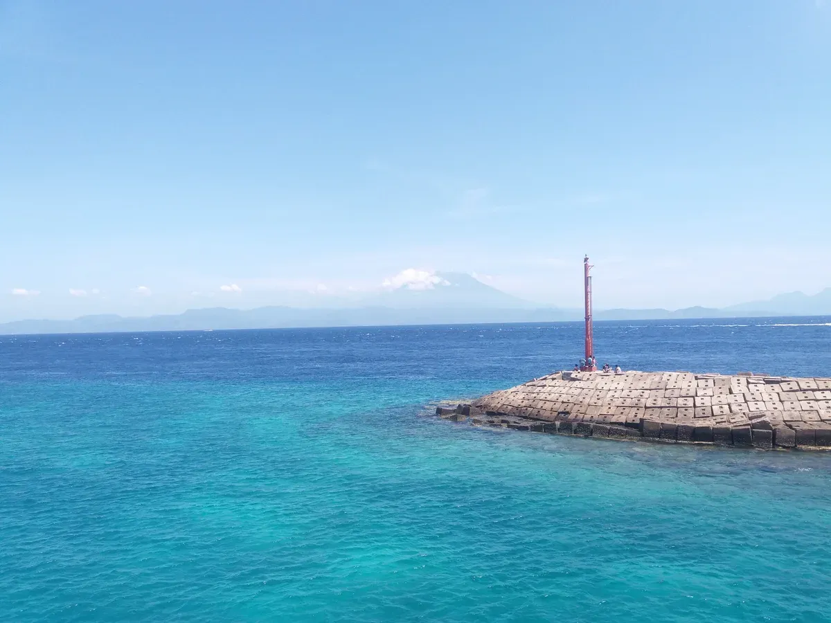
Calm water by a jetty, with the volcanoes of Bali on the horizon. Photo: Maria Bonay, CC BY-SA 4.0, via Wikimedia Commons
Does it rain in Nusa Penida?
Yes, mostly from November to April, with the heaviest months December to February.
The wet months run 197 to 360 mm a month in the model, against 32 to 100 mm from May to September.
Rainy season
BMKG expects most of Indonesia to start the rainy season in November and December, and lists Bali among the areas starting in both months. It expects the peak between December and February.
The island has no rivers and gets its water from springs and rainwater stored in tanks, so rain matters here. A morning start keeps most of your viewpoints dry. Roads with gravel before the sights get slippery, which is another reason to use a driver, as on the East & West Highlights Full-Day Tour.
Sources: InfoPublik, BMKG forecast, Klungkung Regency, Copernicus Climate Data Store.
When's the worst time to go to Bali?
For Nusa Penida the worst months are December to February for rain and June to September for waves, and a visit in either needs a flexible day.
The two problems fall in different seasons.
Rain against waves
December to February is wettest at 347 to 360 mm a month in the model. June to September has the rough sea off the south-west coast, with waves of 2 m or more on 53% of days in June, 61% in July, 65% in August and 48% in September.
November is the exception. It has a wet start but only 6% of days with big waves, and the sea runs 29.2°C. If you want one month, that is the one the data points to for a sea day.
Sources: Copernicus Climate Data Store, Copernicus Marine.
Tours That Fit
One for the sea, one for the roads.
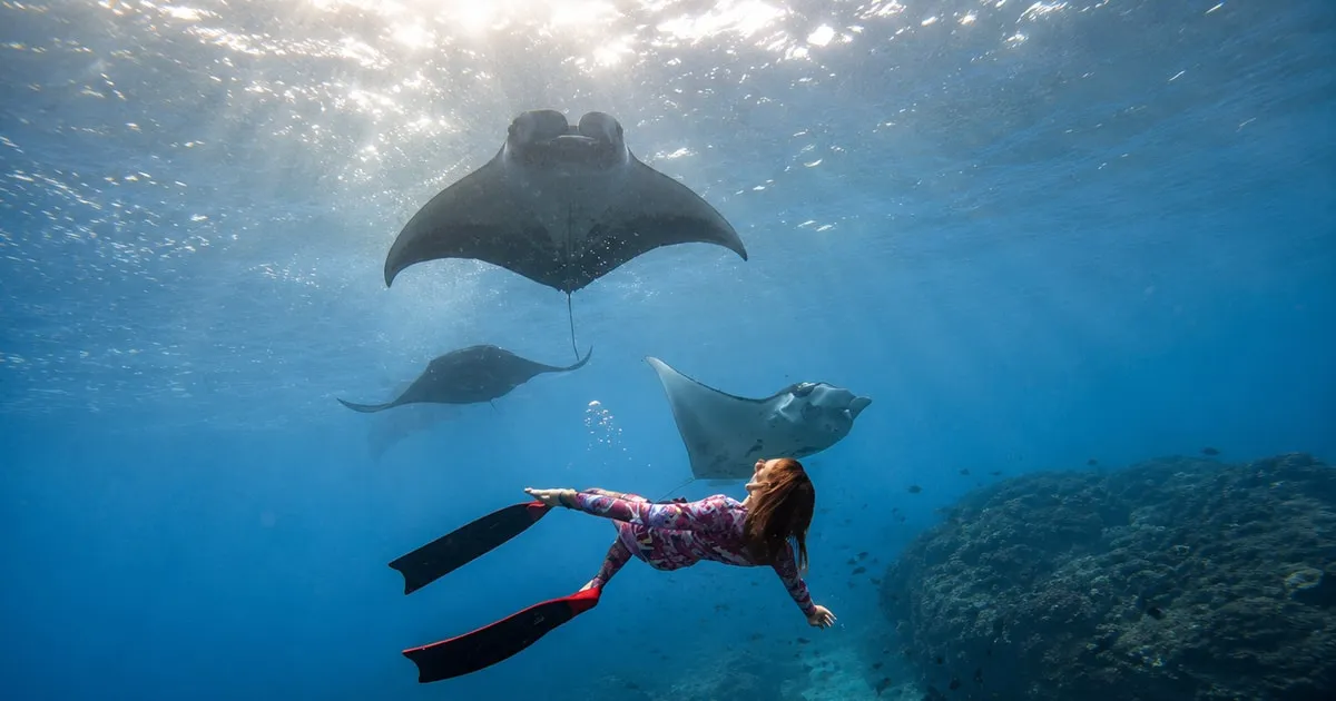 from $43
Snorkel and land
From Bali: 3-Spot Nusa Penida Snorkeling w/ GoPro & West Tour
Three-spot snorkel from Sanur with free GoPro footage and a stated 30 percent manta odds, plus optional west land tour.
Check Availability from $32
Most reviewed
East & West Highlights Full-Day Tour
Both coasts in one day by public fast boat from Sanur with entrance fees included, and a very large review base.
Check AvailabilityHow hot is Nusa Penida by month?
Highs sit between 25.3°C and 27.2°C all year, and the sea runs 26.8-29.9°C.
There is no cold month, so the choice is about rain and waves.
Air and water
July and August are the coolest, with highs of 25.3°C and lows of 21.2°C and 20.8°C. March and April are the warmest at 27.1°C and 27.2°C for the high. The surface sea is warmest in December at 29.9°C and coolest in August at 26.8°C.
The island is hot in the middle of the day, so carry water and hit cliff viewpoints early.
Sources: Copernicus Climate Data Store, Copernicus Marine.
What does the weather mean for the boat and the viewpoints?
Rough water stops boats first, so the sea decides your plans more than rain does.
Forecast sites list wind and rain, and none of the hourly tables carry wave height.
Boats
The Sanur crossing takes about 30 to 45 minutes, depending on sea conditions. Golden Queen may delay, reschedule or cancel for weather and advises a 24-hour buffer before onward travel. Rocky Fast Cruise gives a full refund or a free reschedule when the captain cancels for unsafe conditions. Keep three to four days of buffer before a flight home.
Nyepi on 8 March 2027 stops all land, sea and air transport from 06:00 to 06:00, and tourists stay indoors.
Viewpoints
Kelingking is busiest by midday, so go at first light. Diamond Beach is nearly empty at 7 am and crowded by 9 am. Cliff edges are slippery in rain, and a tourist fell 40 m at Broken Beach in 2023.
Sources: Golden Queen Fast Ferry, Rocky Fast Cruise, Basarnas Bali, Bali Province Media Center.
How should you read a live forecast for Nusa Penida?
Use it for rain, wind and heat, and ask the boat company about waves.
Live forecast sites carry the same few fields, and none of them covers the sea.
What the tables show
The hourly table on yr.no gives wind in m/s, precipitation in mm, humidity and cloud cover for every hour. Daily forecasts show highs of 30°C or 88-91°F, lows near 78°F, wind of 6-10 mph and a shower chance of 40-79%. One daily line reads 2.8 mm of rain with a 57% chance.
Those are live figures for the coming days. The month table above is for planning months ahead, and the two answer different questions.
| Question | Where to look | Gives wave height? |
|---|---|---|
| Will it rain tomorrow? | Hourly or daily forecast | No |
| Is it hot at noon? | Daily high and low | No |
| Will the boat run? | The boat company, on the day | Yes, from the captain |
Pack for it
Carry water, wear a hat and use sun cream at the cliff viewpoints. In the wet months add a light rain layer. Shoes with grip matter on gravel roads and steps.
Keep passports and phones in a dry bag on boats.
Sources: Copernicus Climate Data Store, Golden Queen Fast Ferry.
Which months are best for snorkelling?
November to January, when 2 m waves hit only 6% to 16% of days off the south-west coast.
Manta Point and the south-west coast are the exposed side.
Sea days
Snorkel stops on the south-west side get rough from June to September. The From Bali: 3-Spot Nusa Penida Snorkeling w/ GoPro & West Tour combines three snorkel stops with the west sights, so a calm month gives it the best chance of running as planned. No listing guarantees mantas, and manta rays are fully protected in Indonesia.
The east coast beaches are a different sea. The wave figures here do not describe them.
Sources: Copernicus Marine, BPK Legal Database.
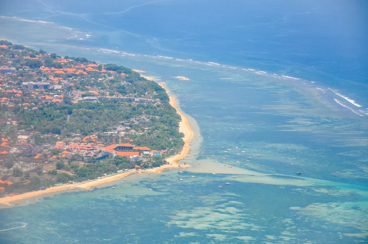
The Sanur coast and its reef from the air, on the Badung Strait. Photo: Jorge Láscar from Melbourne, Australia, CC BY 2.0, via Wikimedia Commons
Nusa Penida Weather: Common Questions
Is it rainy season in Bali right now?
The rainy season starts in November and December and peaks from December to February, per BMKG. Outside those months, plan a dry Nusa Penida day trip.
What is the rainiest month in Bali?
For Nusa Penida the model ranks January highest at 360 mm, then February at 351 mm and December at 347 mm. See the East & West Highlights Full-Day Tour for a road-based day.
Is there a 14 day forecast for Nusa Penida?
Forecast sites such as yr.no give daily and hourly tables, but none of those tables carries wave height. Ask the boat company before a Nusa Penida day trip.
Is there a radar for Nusa Penida weather?
Radar shows rain and not waves, and forecast tables list wind and rain with no wave height. Check sea conditions with the boat operator, and compare each Nusa Penida day trip for free cancellation terms.
How warm is the sea in Nusa Penida?
The surface sea off the south-west coast averages 26.8-29.9°C across the year. The 3-spot snorkelling tour uses that water.
More Guides
- Christmas and New Year in Nusa Penida 2026-27: What to Expect
Christmas and New Year in Nusa Penida 2026-27: what runs on 25 December, the sea in the wet season and when to book. Plan your trip.
- Manta Point Nusa Penida: Can You Swim with Manta Rays?
Manta Point Nusa Penida in 2027: Manta Bay or Manta Point, the sea month by month and what each trip covers. Compare before you book.
- Is Nusa Penida Dangerous? Roads, Cliffs and the Sea
Cliffs, sea, roads and scooters on Nusa Penida with sourced rules for 2027, from a 40 m fall to 2 m waves. See what to avoid.